Bringing GIS, Engineering, and Spatial Data to Life
GIS Solutions for a Connected Continent
Your partner for mapping, spatial analysis, and web GIS.
Empowering Decisions with geoSpatial Intelligence
AMKGeospatial is a specialist geospatial company based in Addis Ababa, Ethiopia. We deliver advanced GIS, mapping, and digital data solutions for organizations and projects across Africa. As the dedicated GIS arm and sister company of Environiqa Engineering PLC, we focus exclusively on GIS, RS, and Geoinformation services
Spatial Data Management
Transform raw data into actionable insights: spatial statistics, hotspot analysis, suitability modeling, and advanced geoprocessing.
GIS Mapping & Surveying
Accurate base maps, field data collection, topographic and parcel mapping using GNSS and drone technologies.
Land Management
Parcel mapping, land registration, asset inventories, and tenure systems for urban and rural areas.
Web-Based GIS Solutions
Interactive online maps and dashboards for data sharing, decision making, and stakeholder engagement.
Remote Sensing
Satellite and drone imagery processing for land use, agriculture, forestry, and urban studies.
Featured Projects
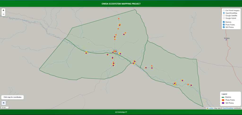
OWDA-Ecosystem Mapping
Interactive Webmap for Integrated Local Ecosystem Mapping, Climate Projection, and Disaster Risk Analysis of Gode, Adadle, and Kelafo Woredas, Shabelle Zone, Somali Region, Ethiopia.
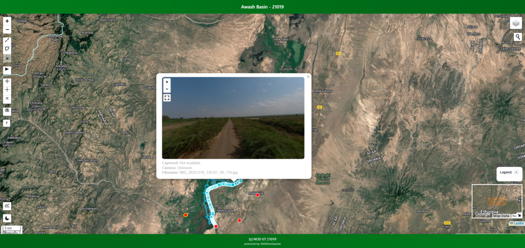
Awash Basin - Flood Risk Assessment
Interactive Flood Hazard Visualization for Awash Basin, Ethiopia.
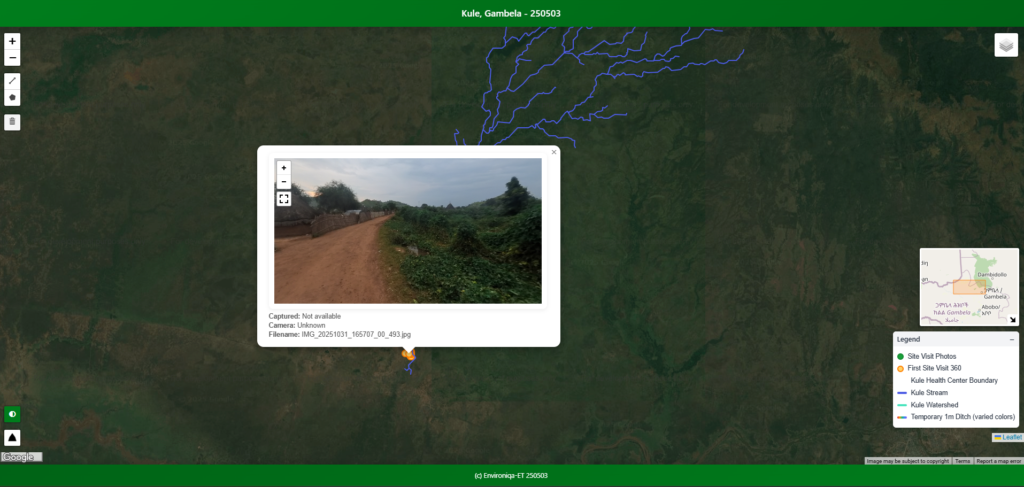
Kule Refugee Camp - Flood Risk Assessment
Interactive Flood Hazard Visualization for MSF-OCA’s Kule Health Center, Gambela, Ethiopia.

Why Choose AMKGeospatial?
- 100% focus on GIS and geospatial solutions
- Over a decade of experience in Africa and beyond through our sister company, Environiqa Engineering plc.
- Advanced technology and field expertise
- Flexible solutions: from field data collection to interactive web maps
- Transparent, collaborative project delivery